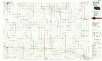
1985 Map of Red Cloud
USGS Topo · Published 1985About this map
The Republican River valley defines the southern tier of this mid-1980s landscape, where water management and agriculture shape the rural grid. Vital infrastructure such as the Superior-Courtland Diversion Dam and the Courtland Canal support the region's farms, while the Burlington Northern railroad lines connect established prairie towns like Red Cloud, Franklin, and Superior.
Find a feature on this map
73 named features on this map. Tap any name to fly to it.
Don’t see what you’re looking for? This feature index may not catch every label — zoom into the map to look around manually.
Map Details
Editions of this 1985 Red Cloud Map
2 editions found
Other maps of this area

1892 · Concordia
USGS Topo · 1:125,000

1893 · Smith Center
USGS Topo · 1:125,000

1893 · Phillipsburg
USGS Topo · 1:125,000

1894 · Mankato
USGS Topo · 1:125,000

1894 · Kenesaw
USGS Topo · 1:62,500

1894 · Kearney
USGS Topo · 1:62,500

1894 · Minden
USGS Topo · 1:62,500

1896 · Holdrege
USGS Topo · 1:125,000

1896 · Kearney
USGS Topo · 1:125,000

1896 · Wood River
USGS Topo · 1:125,000