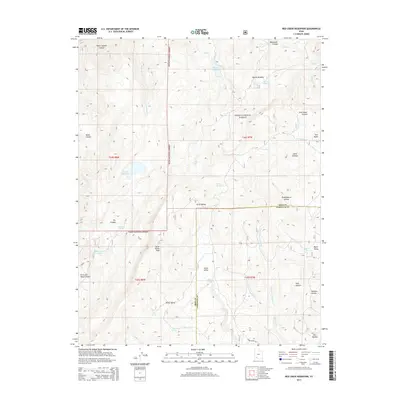
2014 Map of Red Creek Reservoir
USGS Topo · Published 2014About this map
Dixie National Forest defines the high-altitude landscape of this 2014 survey, where the border of Iron and Garfield counties crosses a complex system of plateaus and drainages. The area is characterized by significant water management features, notably the Red Cr Reservoir and Foster Reservoir, which serve as critical nodes in a network of creeks like Red Cr and Haycock Cr. These reservoirs, along with smaller bodies like Hoosier Lake and Horse Lake, highlight the region's reliance on captured snowmelt and spring-fed systems in the southern Utah wilderness.
Find a feature on this map
42 named features on this map. Tap any name to fly to it.
Don’t see what you’re looking for? This feature index may not catch every label — zoom into the map to look around manually.
Map Details
Editions of this 2014 Red Creek Reservoir Map
This is the sole edition of this map. No revisions or reprints were ever made.
Other maps of this area

1886 · Kanab
USGS Topo · 1:250,000

1953 · Cedar City
USGS Topo · 1:250,000

1958 · Cedar City
USGS Topo · 1:250,000

1958 · Cedar Breaks
USGS Topo · 1:62,500

1958 · Panguitch Lake
USGS Topo · 1:62,500

1962 · Cedar City
USGS Topo · 1:250,000

1971 · Paragonah
USGS Topo · 1:24,000
1971 · Cottonwood Mtn
USGS Topo · 1:24,000

1971 · Fivemile Ridge
USGS Topo · 1:24,000

1971 · Parowan
USGS Topo · 1:24,000