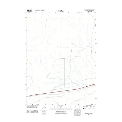
2012 Map of Red Desert NW
USGS Topo · Published 2012About this map
High desert terrain and a sparse network of service roads characterize this section of the Wyoming landscape as it appeared in the early 21st century. The geography is defined by its isolation and the infrastructure required to traverse it, centered around Eagle Nest Butte Rd and the aptly named Desert Flats Rd. These pathways, along with Pipeline Rd, indicate the region's importance for resource management and transport within Sweetwater County.
Find a feature on this map
5 named features on this map. Tap any name to fly to it.
Don’t see what you’re looking for? This feature index may not catch every label — zoom into the map to look around manually.
Map Details
Editions of this 2012 Red Desert NW Map
This is the sole edition of this map. No revisions or reprints were ever made.
Other maps of this area

1954 · Rock Springs
USGS Topo · 1:250,000

1958 · Rock Springs
USGS Topo · 1:250,000

1960 · Red Lake
USGS Topo · 1:62,500

1960 · Lost Creek Butte
USGS Topo · 1:62,500

1962 · Rock Springs
USGS Topo · 1:250,000

1970 · Red Desert SW
USGS Topo · 1:24,000
1970 · Red Desert SE
USGS Topo · 1:24,000

1970 · Red Desert NW
USGS Topo · 1:24,000

1970 · J O Dugway
USGS Topo · 1:24,000

1970 · Tipton
USGS Topo · 1:24,000