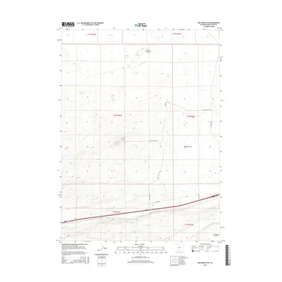
2015 Map of Red Desert NW
USGS Topo · Published 2015About this map
The Continental Divide traverses the high desert landscape of Sweetwater County in this 2015 survey, marking a significant hydrologic boundary. This arid basin area is characterized by sparse infrastructure and topographic depressions such as the Red Desert Basin and Red Wash Draw. The grid of the Public Land Survey System is clearly defined, showing the divisions of t20n r96w and surrounding townships. A handful of desert tracks provide the only passage through this territory, including Triad Ranch Rd and Eagle Nest Butte Rd. These routes serve a region defined more by its physical geography and industrial corridors, such as Pipeline Rd, than by permanent settlements. The map offers a precise view of the remote western Wyoming drainage systems and the subtle relief of the high plateau country.
Find a feature on this map
13 named features on this map. Tap any name to fly to it.
Don’t see what you’re looking for? This feature index may not catch every label — zoom into the map to look around manually.
Map Details
Editions of this 2015 Red Desert NW Map
This is the sole edition of this map. No revisions or reprints were ever made.
Other maps of this area

1954 · Rock Springs
USGS Topo · 1:250,000

1958 · Rock Springs
USGS Topo · 1:250,000

1960 · Red Lake
USGS Topo · 1:62,500

1960 · Lost Creek Butte
USGS Topo · 1:62,500

1962 · Rock Springs
USGS Topo · 1:250,000

1970 · Red Desert SW
USGS Topo · 1:24,000
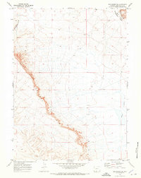
1970 · Red Desert SE
USGS Topo · 1:24,000

1970 · Red Desert NW
USGS Topo · 1:24,000

1970 · J O Dugway
USGS Topo · 1:24,000

1970 · Tipton
USGS Topo · 1:24,000