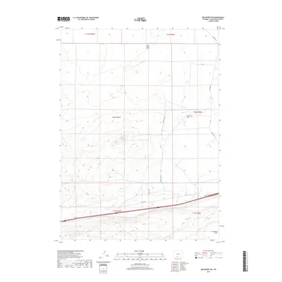
2017 Map of Red Desert NW
USGS Topo · Published 2017About this map
The Continental Divide runs through this portion of Sweetwater County, marking a fundamental hydrological boundary in the high Wyoming desert. The landscape is defined by the broad Red Desert Basin and the drainage of Red Wash Draw, where subtle elevation changes dictate the flow of seasonal water. This 2017 survey shows a sparse but functional network of backcountry roads and industrial infrastructure, including Red Desert Rd and Pipeline Rd, which navigate the interior of the Red Desert. The presence of Triad Ranch Rd and Desert Flats Rd indicates the intersection of ranching interests and public land access. This map provides a detailed view of the township and range survey lines that divide this arid territory into its administrative grid, serving as a modern record of the geographic and logistical layout of this high-altitude basin.
Find a feature on this map
14 named features on this map. Tap any name to fly to it.
Don’t see what you’re looking for? This feature index may not catch every label — zoom into the map to look around manually.
Map Details
Editions of this 2017 Red Desert NW Map
This is the sole edition of this map. No revisions or reprints were ever made.
Other maps of this area

1954 · Rock Springs
USGS Topo · 1:250,000

1958 · Rock Springs
USGS Topo · 1:250,000

1960 · Red Lake
USGS Topo · 1:62,500

1960 · Lost Creek Butte
USGS Topo · 1:62,500

1962 · Rock Springs
USGS Topo · 1:250,000

1970 · Red Desert SW
USGS Topo · 1:24,000
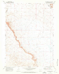
1970 · Red Desert SE
USGS Topo · 1:24,000

1970 · Red Desert NW
USGS Topo · 1:24,000

1970 · J O Dugway
USGS Topo · 1:24,000

1970 · Tipton
USGS Topo · 1:24,000