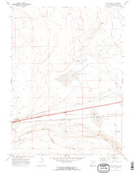
1970 Map of Red Desert
USGS Topo · Published 1973About this map
The Continental Divide winds through this high desert terrain, marking a significant hydrologic boundary in Sweetwater County. The landscape is defined by the massive Wamsutter Depression and the elevations of Big Hill and Wamsutter Big Rim Hill. Human activity here centers on the vital transportation and industrial corridor running east-to-west, where the Union Pacific railroad and numerous pipelines parallel the regional topography. The small settlement of Red Desert and the station at Frewen serve as lone outposts in an area characterized by energy extraction, evidenced by scattered Gas Wells, a Drill Hole, and a Mine. Water management is critical in this arid environment, represented by the Threemile Ditch, Frewen Lake, and a Pumping Sta located near the railway.
Find a feature on this map
18 named features on this map. Tap any name to fly to it.
Don’t see what you’re looking for? This feature index may not catch every label — zoom into the map to look around manually.
Map Details
Editions of this 1970 Red Desert Map
2 editions found
Other maps of this area

1954 · Rawlins
USGS Topo · 1:250,000

1954 · Rock Springs
USGS Topo · 1:250,000

1958 · Rawlins
USGS Topo · 1:250,000

1958 · Rock Springs
USGS Topo · 1:250,000

1960 · Lost Creek Butte
USGS Topo · 1:62,500

1962 · Rawlins
USGS Topo · 1:250,000

1962 · Rock Springs
USGS Topo · 1:250,000

1966 · Wamsutter
USGS Topo · 1:24,000

1966 · Monument Lake
USGS Topo · 1:24,000

1966 · Eightmile Lake
USGS Topo · 1:24,000