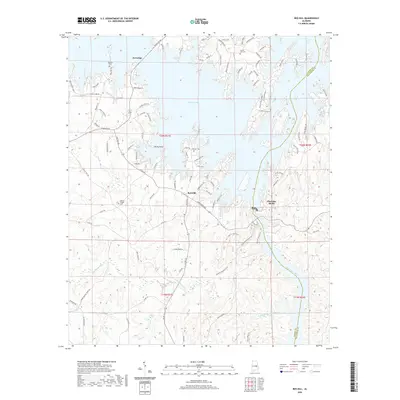
2020 Map of Red Hill
USGS Topo · Published 2020About this map
The waters of Martin Lake dominate this portion of the Elmore and Tallapoosa county line, where the complex shoreline creates numerous fingers of land such as Bear Bryant Pt and S Miller Pt. Settlement is centered around the communities of Kowaliga and Red Hill, connected by the winding path of Kowaliga Rd. The map illustrates a landscape of high ridges and deep inlets, notably at Cherokee Bluffs where Wind Cr meets the main body of water.
Find a feature on this map
105 named features on this map. Tap any name to fly to it.
Don’t see what you’re looking for? This feature index may not catch every label — zoom into the map to look around manually.
Map Details
Editions of this 2020 Red Hill Map
This is the sole edition of this map. No revisions or reprints were ever made.
Other maps of this area

1901 · Wetumpka
USGS Topo · 1:125,000

1901 · Wetumpka
USGS Topo · 1:62,500

1903 · Wetumpka
USGS Topo · 1:125,000

1906 · Dadeville
USGS Topo · 1:125,000

1953 · Montgomery
USGS Topo · 1:250,000

1955 · Phenix City
USGS Topo · 1:250,000

1956 · Montgomery
USGS Topo · 1:250,000

1957 · Phenix City
USGS Topo · 1:250,000

1957 · Montgomery
USGS Topo · 1:250,000

1958 · Phenix City
USGS Topo · 1:250,000