
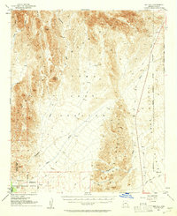
1954 Map of Red Hill
USGS Topo · Published 1955About this map
The Chocolate Mountains and Trigo Mountains define this arid landscape, where the confluence of several major drainage systems like McAllister Wash and Indian Wash shaped the 1950s terrain. This region was a critical area for post-war military and conservation efforts, containing both the Yuma Test Station and the Imperial National Wildlife Refuge.
Find a feature on this map
18 named features on this map. Tap any name to fly to it.
Don’t see what you’re looking for? This feature index may not catch every label — zoom into the map to look around manually.
Map Details
Editions of this 1954 Red Hill Map
3 editions found
Other maps of this area

1903 · Yuma
USGS Topo · 1:125,000

1905 · Yuma
USGS Topo · 1:125,000

1929 · Laguna
USGS Topo · 1:62,500

1934 · Trigo Peaks
USGS Topo · 1:48,000

1939 · Red Hill
USGS Topo · 1:62,500

1939 · Trigo Peaks
USGS Topo · 1:62,500

1942 · Yuma
USGS Topo · 1:250,000

1942 · Blythe
USGS Topo · 1:250,000

1943 · Laguna
USGS Topo · 1:62,500

1945 · Picacho Peak
USGS Topo · 1:62,500