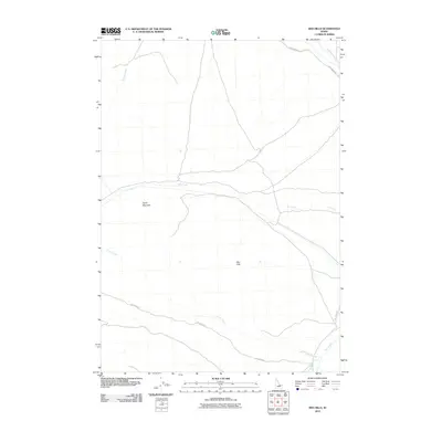
2010 Map of Red Hills
USGS Topo · Published 2010About this map
Taylor Mountain and the Red Hills anchor this high-desert Idaho landscape, where seasonal watercourses and gravel roads provide the primary landmarks. The terrain is defined by a series of drainage systems, including the long reach of Dry Creek and its southern neighbor Corral Creek. These intermittent streams dictate the movement across the quadrangle, with Dry Creek Rd following the natural contours of the valley floor.
Find a feature on this map
10 named features on this map. Tap any name to fly to it.
Don’t see what you’re looking for? This feature index may not catch every label — zoom into the map to look around manually.
Map Details
Editions of this 2010 Red Hills Map
This is the sole edition of this map. No revisions or reprints were ever made.
Other maps of this area

1935 · Borah Peak
USGS Topo · 1:125,000

1938 · Borah Peak
USGS Topo · 1:125,000

1955 · Dubois
USGS Topo · 1:250,000

1956 · Donkey Hills
USGS Topo · 1:62,500

1957 · Gilmore
USGS Topo · 1:62,500

1957 · Hawley Mountain
USGS Topo · 1:62,500

1958 · Dubois
USGS Topo · 1:250,000
1967 · Massacre Mtn
USGS Topo · 1:24,000
1967 · Short Creek
USGS Topo · 1:24,000
1987 · Mulkey Bar
USGS Topo · 1:24,000