2022 Map of Red Lake
USGS Topo · Published 2022About this map
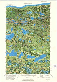
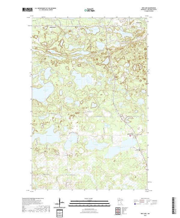
The community of Little Rock sits near the northern boundary of this lake-studded landscape, where a dense network of reservation highways and local roads connects small settlements across the marshy terrain of Beltrami County. The geography is defined by a staggering concentration of named water bodies, including the large expanse of Kesagiagan Lake and the more remote Ankeewinsee Lake. A significant cultural landmark is the Island Lake Cem, located near the southern village of Island Lake. The road system, featuring routes like Resvn Hwy 10 and Lumberjack Rd NW, highlights the local importance of forestry and tribal connectivity. From Balm Lake in the west to Thunder Lake in the east, the map reveals a complex wetland environment where small family-named access roads like Haggerty Dr NW thread through the forest to reach secluded shorelines.
Find a feature on this map
69 named features on this map. Tap any name to fly to it.
Don’t see what you’re looking for? This feature index may not catch every label — zoom into the map to look around manually.
Map Details
Editions of this 2022 Red Lake Map
This is the sole edition of this map. No revisions or reprints were ever made.