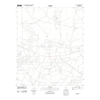
2010 Map of Red Lake
USGS Topo · Published 2010About this map
Red Lake Oil Field and the surrounding energy landscape dominate this 2010 survey of Eddy County. The area is defined by a dense network of extraction infrastructure and service roads, including the Artesia Oil Field, Empire Oil Field, and the Vandergriff Keys Gas Field. This industrial activity sits atop a terrain marked by ephemeral water systems such as Red Lake and several significant topographic drainages like Hart Canyon, Logan Draw, and Chalk Bluff Draw.
Find a feature on this map
31 named features on this map. Tap any name to fly to it.
Don’t see what you’re looking for? This feature index may not catch every label — zoom into the map to look around manually.
Map Details
Editions of this 2010 Red Lake Map
This is the sole edition of this map. No revisions or reprints were ever made.
Other maps of this area

1943 · Oil City
USGS Topo · 1:62,500

1951 · Diamond Mound
USGS Topo · 1:24,000

1953 · Basin Well
USGS Topo · 1:24,000

1954 · Carlsbad
USGS Topo · 1:250,000

1955 · Artesia NE
USGS Topo · 1:24,000

1955 · Spring Lake
USGS Topo · 1:24,000

1955 · Red Lake SE
USGS Topo · 1:24,000

1955 · Lake Mc Millan North
USGS Topo · 1:24,000

1955 · Red Lake
USGS Topo · 1:24,000

1958 · Carlsbad
USGS Topo · 1:250,000