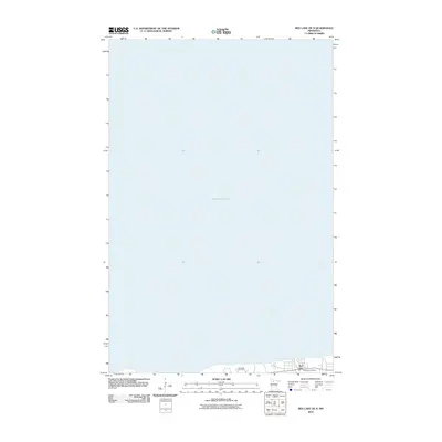
2010 Map of Red Lake OE N
USGS Topo · Published 2010About this map
Lower Red Lake dominates this northern Minnesota landscape, where the waters of the vast basin meet the southern shoreline in the community of Red Lake. This 2010 survey highlights the concentrated settlement patterns on the lake's edge, anchored by the Redlake Post Office and nearby infrastructure. The map provides a clear view of the local topography where Pike Creek flows into the lake, marking a significant hydrological point for the area. Genealogists and local historians can pinpoint the location of the Red Lake Cemetery, situated just west of the main town center, which serves as a central landmark for documenting the area's residents. The layout of the roads and residential clusters along the shoreline illustrates the community's orientation toward the water, reflecting the importance of the lake to the region's geography and daily life.
Find a feature on this map
5 named features on this map. Tap any name to fly to it.
Don’t see what you’re looking for? This feature index may not catch every label — zoom into the map to look around manually.
Map Details
Editions of this 2010 Red Lake OE N Map
This is the sole edition of this map. No revisions or reprints were ever made.
Other maps of this area

1919 · Ponemah
USGS Topo · 1:62,500

1943 · Ponemah
USGS Topo · 1:62,500

1954 · Bemidji
USGS Topo · 1:250,000

1954 · Roseau
USGS Topo · 1:250,000

1957 · Roseau
USGS Topo · 1:250,000

1957 · Bemidji
USGS Topo · 1:250,000

1958 · Bemidji
USGS Topo · 1:250,000

1958 · Roseau
USGS Topo · 1:250,000

1972 · Bagley Lake
USGS Topo · 1:24,000

1972 · Redby
USGS Topo · 1:24,000