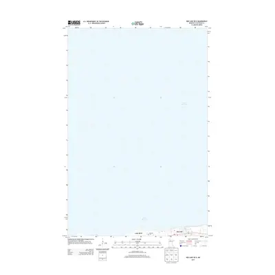
2013 Map of Red Lake OE N
USGS Topo · Published 2013About this map
Lower Red Lake dominates the expanse of this northern Minnesota survey, with its deep blue waters covering the vast majority of the quadrangle. Along the narrow southern shoreline, the community of Red Lake serves as a focal point for the region, where the local Po and Red-Lake Cem are situated just off the primary thoroughfare, Mn-1. Moving west along the coast, the settlement of Little Rock sits near the water's edge, reflecting a settlement pattern tethered closely to the lake. This 2013 edition illustrates the geographic relationship between these lakeside communities and the massive body of water that defines their environment, providing a clear view of the road network and shoreline developments at the time.
Find a feature on this map
6 named features on this map. Tap any name to fly to it.
Don’t see what you’re looking for? This feature index may not catch every label — zoom into the map to look around manually.
Map Details
Editions of this 2013 Red Lake OE N Map
This is the sole edition of this map. No revisions or reprints were ever made.
Other maps of this area

1919 · Ponemah
USGS Topo · 1:62,500

1943 · Ponemah
USGS Topo · 1:62,500

1954 · Bemidji
USGS Topo · 1:250,000

1954 · Roseau
USGS Topo · 1:250,000

1957 · Roseau
USGS Topo · 1:250,000

1957 · Bemidji
USGS Topo · 1:250,000

1958 · Bemidji
USGS Topo · 1:250,000

1958 · Roseau
USGS Topo · 1:250,000

1972 · Bagley Lake
USGS Topo · 1:24,000

1972 · Redby
USGS Topo · 1:24,000