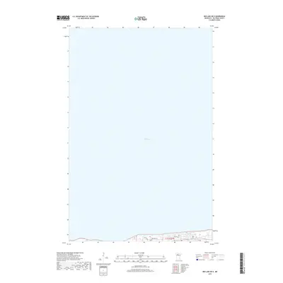
2019 Map of Red Lake OE N
USGS Topo · Published 2019About this map
Lower Red Lake dominates this northern Minnesota landscape, where the vast water body meets a thin strip of developed shoreline at the southern edge of the sheet. The map documents a localized network of infrastructure, including Nay Ah Shing and Hospital Rd, which serve the small lakeside community. Genealogists and local historians will find the Red Lake Cem positioned near the water's edge, a significant landmark for the area. The drainage of Pike Cr flows into the lake, marking the intersection of the region's natural hydrography and its residential footprint within township t151n r34w.
Find a feature on this map
6 named features on this map. Tap any name to fly to it.
Don’t see what you’re looking for? This feature index may not catch every label — zoom into the map to look around manually.
Map Details
Editions of this 2019 Red Lake OE N Map
This is the sole edition of this map. No revisions or reprints were ever made.
Other maps of this area

1919 · Ponemah
USGS Topo · 1:62,500

1943 · Ponemah
USGS Topo · 1:62,500

1954 · Bemidji
USGS Topo · 1:250,000

1954 · Roseau
USGS Topo · 1:250,000

1957 · Roseau
USGS Topo · 1:250,000

1957 · Bemidji
USGS Topo · 1:250,000

1958 · Bemidji
USGS Topo · 1:250,000

1958 · Roseau
USGS Topo · 1:250,000

1972 · Bagley Lake
USGS Topo · 1:24,000

1972 · Redby
USGS Topo · 1:24,000