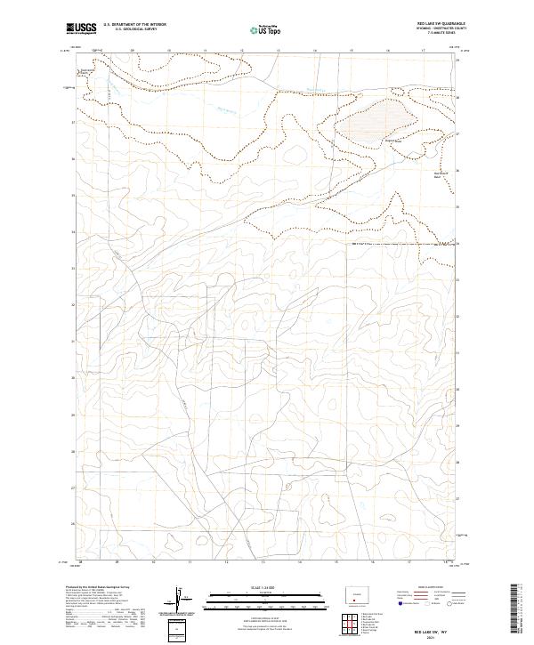
2021 Map of Red Lake SW
USGS Topo · Published 2021About this map
The Red Desert Basin dominates this portion of Sweetwater County, presenting a high-altitude arid landscape defined by subtle drainage patterns and minimal human development. Water follows ephemeral paths through Twelvemile Gulch, Black Rock Cr, and Dugout Draw, illustrating the hydrological challenges of this interior drainage basin. The map reflects a modern era of remote land management where transport is limited to established county routes like Co Rd 21 and Co Rd 20. These gravel and dirt roads provide the primary access to vast tracts of public land within the Public Land Survey System grids of t22n r98w and t21n r97w. This landscape serves as a record of late 20th and early 21st-century rangeland, where the grid of sections and townships overlays a topography shaped by wind and intermittent water.
Find a feature on this map
11 named features on this map. Tap any name to fly to it.
Don’t see what you’re looking for? This feature index may not catch every label — zoom into the map to look around manually.
Map Details
Editions of this 2021 Red Lake SW Map
This is the sole edition of this map. No revisions or reprints were ever made.
Other maps of this area

1954 · Rock Springs
USGS Topo · 1:250,000

1958 · Rock Springs
USGS Topo · 1:250,000

1958 · Twelvemile Well
USGS Topo · 1:62,500

1960 · Red Lake
USGS Topo · 1:62,500

1962 · Rock Springs
USGS Topo · 1:250,000

1968 · Bitter Creek NE
USGS Topo · 1:24,000

1970 · Tipton
USGS Topo · 1:24,000
1970 · Desert Springs
USGS Topo · 1:24,000
1980 · Red Desert Basin
USGS Topo · 1:100,000
1986 · Black Rock Flat East
USGS Topo · 1:24,000