
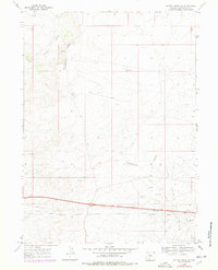
1968 Map of Bitter Creek NE
USGS Topo · Published 1972About this map
The Continental Divide winds through this high desert terrain in the late 1960s, a geographic spine that separates the western and eastern watersheds of the continent. This portion of Sweetwater County is dominated by the industrial infrastructure of the Patrick Draw Oil Field, characterized by a network of Pipelines and numerous extraction sites. The landscape is marked by resource development, including several Gas Wells, an Oil Well, and a specialized Gas Plant situated in the southern sections.
Find a feature on this map
18 named features on this map. Tap any name to fly to it.
Don’t see what you’re looking for? This feature index may not catch every label — zoom into the map to look around manually.
Map Details
Editions of this 1968 Bitter Creek NE Map
2 editions found
Other maps of this area

1954 · Rock Springs
USGS Topo · 1:250,000

1958 · Rock Springs
USGS Topo · 1:250,000

1958 · Twelvemile Well
USGS Topo · 1:62,500

1960 · Red Lake
USGS Topo · 1:62,500

1962 · Rock Springs
USGS Topo · 1:250,000

1968 · Bitter Creek NW
USGS Topo · 1:24,000

1968 · Bitter Creek
USGS Topo · 1:24,000

1968 · Black Buttes
USGS Topo · 1:24,000

1970 · Table Rock
USGS Topo · 1:24,000
1970 · Desert Springs
USGS Topo · 1:24,000