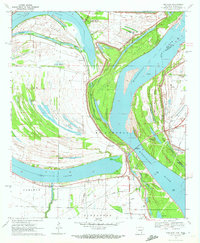
1970 Map of Red Leaf
USGS Topo · Published 1972About this map
The Mississippi River and the sweeping curve of Lake Chicot dominate this landscape on the Arkansas-Mississippi border. The river's historical shifts are recorded in numerous secondary channels and islands, including Leland Chute, Whiskey Chute, and Stuart Island. Away from the water's edge, the land is organized for agriculture, notably featuring a large Fish Farm and the Sunnyside and Red Leaf settlements. Local history is deeply embedded in the map's details, from small rural congregations like Jerusalem Ch and Lakeport Ch to the several family and community burial grounds such as Old Refuge Cem and Red Leaf Cem. This 1970 snapshot preserves the era's rural infrastructure, showing a dedicated Landing Strip and specialized resources like the Lake Chicot State Park near the river's northern bend.
Find a feature on this map
39 named features on this map. Tap any name to fly to it.
Don’t see what you’re looking for? This feature index may not catch every label — zoom into the map to look around manually.
Map Details
Editions of this 1970 Red Leaf Map
2 editions found
Other maps of this area

1936 · Eudora
USGS Topo · 1:62,500

1936 · Lake Village
USGS Topo · 1:62,500

1939 · Readland
USGS Topo · 1:62,500

1939 · Refuge
USGS Topo · 1:62,500

1953 · Greenwood
USGS Topo · 1:250,000

1955 · Lake Village
USGS Topo · 1:62,500

1956 · Greenwood
USGS Topo · 1:250,000

1957 · Eudora
USGS Topo · 1:62,500
1970 · Luna
USGS Topo · 1:24,000
1970 · Greenville
USGS Topo · 1:24,000