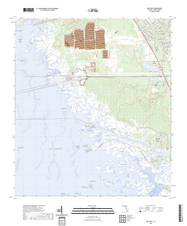
2025 Map of Red Level
USGS Topo · Published 2025About this map
Crystal River Preserve State Park dominates this coastal landscape, protecting a labyrinth of salt marshes and islands where the freshwater of the Crystal River meets the Gulf of America. The settlement of Red Level sits inland, characterized by a residential street grid including W Dunnellon Rd and N Suncoast Blvd. Local history is anchored at the Red Level Cem and the Johns Family Cem, while the industrial history of the region is etched into the earth by the Cross Florida Barge Canal to the north. The shoreline is a complex network of named features such as Black Point, Fort Island Beach, and Dixie Bay, reflecting a coastal economy and environment defined by its tidal creeks like Dolphin Creek and Salt Creek.
Find a feature on this map
94 named features on this map. Tap any name to fly to it.
Don’t see what you’re looking for? This feature index may not catch every label — zoom into the map to look around manually.
Map Details
Editions of this 2025 Red Level Map
This is the sole edition of this map. No revisions or reprints were ever made.
Other maps of this area

1954 · Homosassa
USGS Topo · 1:24,000

1954 · Crystal River
USGS Topo · 1:24,000

1954 · Red Level
USGS Topo · 1:24,000

1954 · Yankeetown SE
USGS Topo · 1:24,000

1954 · Ozello
USGS Topo · 1:24,000

1954 · Gainesville
USGS Topo · 1:250,000

1955 · Withlacoochee Bay
USGS Topo · 1:24,000

1955 · Yankeetown
USGS Topo · 1:24,000

1955 · Plant City
USGS Topo · 1:250,000

1958 · Plant City
USGS Topo · 1:250,000