
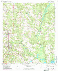
1971 Map of Red Level
USGS Topo · Published 1973About this map
Red Level serves as the primary hub of this south Alabama landscape, situated near the southwestern corner where the Louisville and Nashville railroad cuts through the terrain. The community infrastructure of the early 1970s is well-documented, showing the local High Sch and several houses of worship, including Jernigan Ch and the centrally located Fairmount Cem. To the west, Crystal Springs Park provides a clear landmark near the town's edge.
Find a feature on this map
30 named features on this map. Tap any name to fly to it.
Don’t see what you’re looking for? This feature index may not catch every label — zoom into the map to look around manually.
Map Details
Editions of this 1971 Red Level Map
2 editions found
Other maps of this area

1953 · Andalusia
USGS Topo · 1:250,000

1957 · Andalusia
USGS Topo · 1:250,000

1971 · Brooks
USGS Topo · 1:24,000

1971 · Industry
USGS Topo · 1:24,000

1971 · River Falls
USGS Topo · 1:24,000

1971 · Mc Kenzie
USGS Topo · 1:24,000

1971 · Andalusia
USGS Topo · 1:24,000

1971 · Gantt
USGS Topo · 1:24,000

1971 · Leon
USGS Topo · 1:24,000

1971 · Loango
USGS Topo · 1:24,000