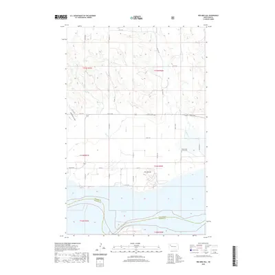
2020 Map of Red Mike Hill
USGS Topo · Published 2020About this map
Lake Sakakawea dominates the southern boundary of this landscape where the Williams Co McKenzie Co line follows the submerged channel of the Missouri River. The terrain is defined by a series of drainage systems, including Thorsen Cr, Beaver Cr, and Nelson Cr, which cut through the high plains toward the reservoir. On the upland flats, a grid of section-line roads like 54th St NW and Co Rd 17A serves the agricultural interior. For those tracing local heritage, the Beaver Creek Lutheran Cem remains a significant marker of early settlement near the eastern edge. The prominent rise of Red Mike Hill stands as a distinct topographic landmark above the coulees, including the descriptively named Half Breed Coulee, illustrating the complex physical geography before the land drops away into the vast waters of the Sakakawea.
Find a feature on this map
18 named features on this map. Tap any name to fly to it.
Don’t see what you’re looking for? This feature index may not catch every label — zoom into the map to look around manually.
Map Details
Editions of this 2020 Red Mike Hill Map
This is the sole edition of this map. No revisions or reprints were ever made.
Other maps of this area

1911 · Ray
USGS Topo · 1:125,000

1953 · Williston
USGS Topo · 1:250,000

1957 · Williston
USGS Topo · 1:250,000

1965 · Charlson SW
USGS Topo · 1:24,000

1965 · Charlson NW
USGS Topo · 1:24,000

1969 · Cussicks Spring
USGS Topo · 1:24,000

1969 · Red Mike Hill
USGS Topo · 1:24,000

1978 · Ray
USGS Topo · 1:24,000

1978 · Tobacco Garden Bay
USGS Topo · 1:24,000

1978 · Ray SE
USGS Topo · 1:24,000