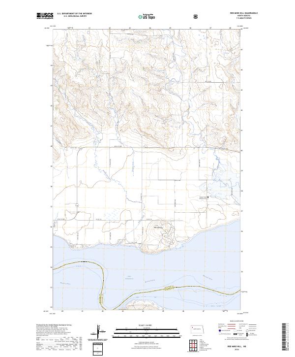
2024 Map of Red Mike Hill
USGS Topo · Published 2024About this map
Red Mike Hill stands as a prominent landmark overlooking the expansive waters of Lake Sakakawea and the Missouri River, marking a rugged intersection of Williams and McKenzie Counties. This landscape is defined by the deep incisions of Beaver Creek and Nelson Creek as they cut through the northern plains to meet the reservoir. The presence of the Beaver Creek Lutheran Cem near the intersection of 109th Ave NW and 53rd St NW provides a vital touchstone for genealogists and local historians, anchoring the agricultural heritage of the surrounding townships. The grid of section roads, including Co Hwy 17 A and 54th St NW, illustrates the enduring structure of North Dakota's rural homesteads in an era where the proximity to the Missouri River remains a dominant geographical influence.
Find a feature on this map
28 named features on this map. Tap any name to fly to it.
Don’t see what you’re looking for? This feature index may not catch every label — zoom into the map to look around manually.
Map Details
Editions of this 2024 Red Mike Hill Map
This is the sole edition of this map. No revisions or reprints were ever made.
Other maps of this area

1911 · Ray
USGS Topo · 1:125,000

1953 · Williston
USGS Topo · 1:250,000

1957 · Williston
USGS Topo · 1:250,000

1965 · Charlson SW
USGS Topo · 1:24,000

1965 · Charlson NW
USGS Topo · 1:24,000

1969 · Cussicks Spring
USGS Topo · 1:24,000

1969 · Red Mike Hill
USGS Topo · 1:24,000

1978 · Ray
USGS Topo · 1:24,000

1978 · Tobacco Garden Bay
USGS Topo · 1:24,000

1978 · Ray SE
USGS Topo · 1:24,000