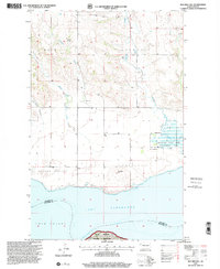
1997 Map of Red Mike Hill
USGS Topo · Published 2001About this map
Lake Sakakawea and the Missouri River define the southern landscape of this Williams County region, where the prairie uplands meet the water. The map documents the rural infrastructure of Hofflund and View Farmvale, showing a pattern of scattered homesteads supported by local institutions like Beaver Creek Ch and Hofflund Sch. The rugged break-country is etched by drainage features such as Half Breed Coulee, Thorson Creek, and Nelson Creek, which lead toward the reservoir's edge.
Find a feature on this map
20 named features on this map. Tap any name to fly to it.
Don’t see what you’re looking for? This feature index may not catch every label — zoom into the map to look around manually.
Map Details
Editions of this 1997 Red Mike Hill Map
This is the sole edition of this map. No revisions or reprints were ever made.
Other maps of this area

1911 · Ray
USGS Topo · 1:125,000

1953 · Williston
USGS Topo · 1:250,000

1957 · Williston
USGS Topo · 1:250,000

1965 · Charlson SW
USGS Topo · 1:24,000

1965 · Charlson NW
USGS Topo · 1:24,000

1969 · Cussicks Spring
USGS Topo · 1:24,000

1969 · Red Mike Hill
USGS Topo · 1:24,000

1978 · Ray
USGS Topo · 1:24,000

1978 · Tobacco Garden Bay
USGS Topo · 1:24,000

1978 · Ray SE
USGS Topo · 1:24,000