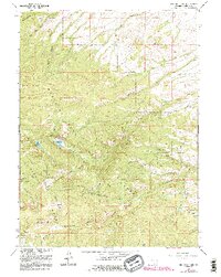
1961 Map of Red Mountain
USGS Topo · Published 1995About this map
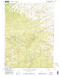
Red Mountain and Doane Peak dominate the high-elevation landscape of the Sierra Madre range in this mid-century survey of Carbon County. The Continental Divide snake through the western portion of the map, separating the headwaters of the Encampment River from the westward-draining Cow Creek. This area within the Medicine Bow National Forest preserves clear evidence of the region’s early mining activity, most notably at the Rambler Mine and the Battle (Site) near the historic Battle Pass.
Find a feature on this map
34 named features on this map. Tap any name to fly to it.
Don’t see what you’re looking for? This feature index may not catch every label — zoom into the map to look around manually.
Map Details
Editions of this 1961 Red Mountain Map
6 editions found
Other maps of this area

1932 · Savery
USGS Topo · 1:96,000

1939 · Saratoga
USGS Topo · 1:125,000

1940 · Savery
USGS Topo · 1:125,000

1954 · Rawlins
USGS Topo · 1:250,000

1958 · Rawlins
USGS Topo · 1:250,000

1961 · Red Mountain
USGS Topo · 1:24,000

1961 · Bridger Peak
USGS Topo · 1:24,000

1961 · Encampment
USGS Topo · 1:24,000
1961 · Dudley Creek
USGS Topo · 1:24,000
1961 · Cow Creek Ranch
USGS Topo · 1:24,000