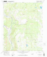
1967 Map of Red Mountain
USGS Topo · Published 1969About this map
The Conejos River winds through this high-altitude landscape within the Rio Grande National Forest, as documented in the late 1960s. The geography is defined by a series of steep drainages including California Gulch, Fisher Gulch, and Robinson Gulch that feed into the river valley. Evidence of seasonal livestock management is seen in the numerous labels for a Stock Driveway and a Jeep Trail that cross the high country near peaks like Red Mountain and Willow Mountain. Small pockets of human activity appear at the Lake Fork Ranch and the Lake Fork Campground. Farther south, the map identifies the settlement of Valdez and the sprawling La Jara Meadows. Notable water features like Acascosa Lake, Empedrado Lake, and Beaver Lake are tucked into the drainages of the South Fork and Lake Fork Creek.
Find a feature on this map
40 named features on this map. Tap any name to fly to it.
Don’t see what you’re looking for? This feature index may not catch every label — zoom into the map to look around manually.
Map Details
Editions of this 1967 Red Mountain Map
3 editions found
Other maps of this area

1913 · Summitville
USGS Topo · 1:125,000

1915 · Summitville
USGS Topo · 1:125,000

1922 · Conejos
USGS Topo · 1:125,000

1945 · Durango
USGS Topo · 1:250,000

1953 · Durango
USGS Topo · 1:250,000

1954 · Durango
USGS Topo · 1:250,000

1957 · Chama Peak
USGS Topo · 1:62,500

1961 · Durango
USGS Topo · 1:250,000

1963 · Durango
USGS Topo · 1:250,000

1966 · Durango
USGS Topo · 1:250,000