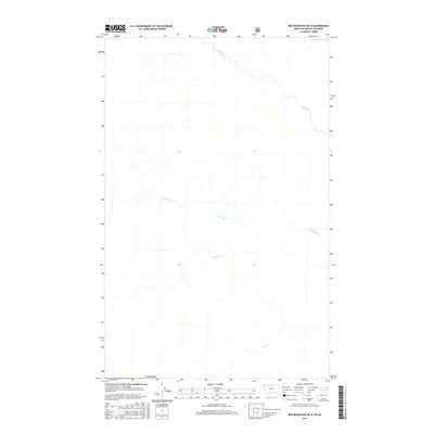
2017 Map of Red Mountain OE N
USGS Topo · Published 2017About this map
Lake Koocanusa dominates the northeastern corner of this 2017 survey area, which straddles the international boundary between Montana and British Columbia. This section of the Kootenay River valley is defined by its complex drainage systems, where Gold Creek flows toward the reservoir and numerous seasonal and perennial streams like Purcell Cr and Linklater Cr navigate the western slopes. Further south, Sink Cr marks the landscape as it moves through the southern reaches near the border. The topography documented here by the U.S. Geological Survey shows a transitional mountain environment where water resources are the primary named features. Because this map reaches up to the Canada line, it provides essential context for the trans-border hydrography that feeds into the larger Koocanusa system.
Find a feature on this map
6 named features on this map. Tap any name to fly to it.
Don’t see what you’re looking for? This feature index may not catch every label — zoom into the map to look around manually.
Map Details
Editions of this 2017 Red Mountain OE N Map
This is the sole edition of this map. No revisions or reprints were ever made.
Other maps of this area

1957 · Kalispell
USGS Topo · 1:250,000

1960 · Kalispell
USGS Topo · 1:250,000

1961 · Kalispell
USGS Topo · 1:250,000

1963 · Rexford
USGS Topo · 1:24,000

1963 · Robinson Mountain
USGS Topo · 1:24,000

1963 · Red Mountain
USGS Topo · 1:24,000

1979 · Yaak River
USGS Topo · 1:100,000
1983 · Rexford
USGS Topo · 1:24,000
1997 · Robinson Mountain
USGS Topo · 1:24,000
1997 · Rexford
USGS Topo · 1:24,000