
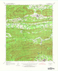
1940 Map of Red Oak
USGS Topo · Published 1971About this map
The Sans Bois Mountains and Winding Stair Mountain dominate this landscape on the border of Latimer and Le Flore counties. At the turn of the 1940s, the region was defined by its dual railroad corridors: the Chicago Rock Island and Pacific runs through the northern valley near Red Oak, while the St Louis San Francisco serves the southern communities like Talihina. This era shows a distributed network of rural education, with localized schools such as Boggy Sch, Denmon Sch, and Hulsey Prairie Sch serving scattered valley settlements. The presence of the State Sanitorium and US Hospital near Talihina marks the town as a significant regional center for healthcare during this period. Extensive water networks, including Fourche Maline and the Kiamichi River, drain the high ridges of the Ouachita National Forest.
Find a feature on this map
69 named features on this map. Tap any name to fly to it.
Don’t see what you’re looking for? This feature index may not catch every label — zoom into the map to look around manually.
Map Details
Editions of this 1940 Red Oak Map
2 editions found
Other maps of this area

1900 · Sansbois
USGS Topo · 1:125,000

1900 · Sallisaw
USGS Topo · 1:125,000

1900 · Winding Stair
USGS Topo · 1:125,000

1901 · Tuskahoma
USGS Topo · 1:125,000

1908 · Tuskahoma
USGS Topo · 1:125,000

1909 · Tuskahoma
USGS Topo · 1:125,000

1909 · Winding Stair
USGS Topo · 1:125,000

1909 · Sans Bois
USGS Topo · 1:125,000

1911 · Sallisaw
USGS Topo · 1:125,000

1911 · Sansbois
USGS Topo · 1:125,000