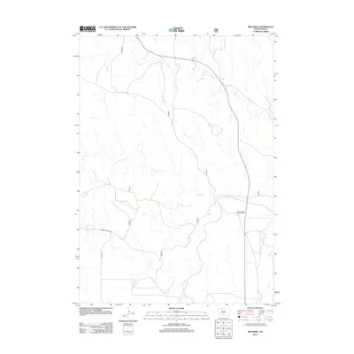
2012 Map of Red Shirt
USGS Topo · Published 2012About this map
Red Shirt stands at the confluence of several significant watercourses, marking a critical junction in the landscape where Red Shirt Cr and Battle Cr drain into the broad Cheyenne River valley. The map reveals a drainage pattern defined by the persistent flow of western South Dakota prairie streams, with French Cr winding through the southern reaches alongside rural corridors such as E French Creek Rd.
Find a feature on this map
11 named features on this map. Tap any name to fly to it.
Don’t see what you’re looking for? This feature index may not catch every label — zoom into the map to look around manually.
Map Details
Editions of this 2012 Red Shirt Map
This is the sole edition of this map. No revisions or reprints were ever made.
Other maps of this area

1894 · Hermosa
USGS Topo · 1:125,000

1901 · Hermosa
USGS Topo · 1:125,000

1951 · Fairburn SE
USGS Topo · 1:24,000

1951 · Red Shirt
USGS Topo · 1:24,000

1951 · Red Shirt NE
USGS Topo · 1:24,000

1951 · Red Shirt SW
USGS Topo · 1:24,000

1951 · Cuny Table West
USGS Topo · 1:24,000

1953 · Hermosa SE
USGS Topo · 1:24,000

1953 · Folsom
USGS Topo · 1:24,000

1953 · Caputa SW
USGS Topo · 1:24,000