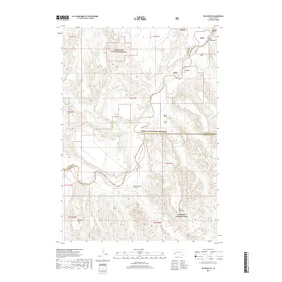
2017 Map of Red Shirt NE
USGS Topo · Published 2017About this map
The Cheyenne River carves a winding path through this western South Dakota landscape, defining the boundaries between Pennington, Custer, and Oglala Lakota counties. This 2017 survey illustrates the intersection of significant public lands, including the rugged eastern margins of the Buffalo Gap National Grassland and the northern reaches of Badlands National Park.
Find a feature on this map
24 named features on this map. Tap any name to fly to it.
Don’t see what you’re looking for? This feature index may not catch every label — zoom into the map to look around manually.
Map Details
Editions of this 2017 Red Shirt NE Map
This is the sole edition of this map. No revisions or reprints were ever made.
Other maps of this area

1950 · Cuny Table East
USGS Topo · 1:24,000

1951 · Red Shirt
USGS Topo · 1:24,000

1951 · Heutmacher Table
USGS Topo · 1:24,000

1951 · Red Shirt NE
USGS Topo · 1:24,000

1951 · Red Shirt SW
USGS Topo · 1:24,000

1951 · Cuny Table West
USGS Topo · 1:24,000

1953 · Folsom
USGS Topo · 1:24,000

1953 · Caputa SW
USGS Topo · 1:24,000

1954 · Scenic SW
USGS Topo · 1:24,000

1955 · Hot Springs
USGS Topo · 1:250,000