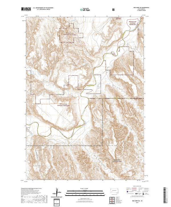
2021 Map of Red Shirt NE
USGS Topo · Published 2021About this map
The Cheyenne River winds through a landscape defined by dramatic tablelands and complex drainage systems along the borders of Custer, Pennington, and Oglala Lakota Counties. This western South Dakota terrain is largely preserved within the Buffalo Gap National Grassland and the northern reaches of Badlands National Park. High plateaus such as Plenty Star Table and Blindman Table overlook deep-cut features like Battle Creek Canyon, demonstrating the erosive power of the region's intermittent waterways. Access to these higher elevations is provided by routes such as Blindman Table Road. The map documents an intricate network of dry washes and draws, including Little Corral Draw, Big Corral Draw, and Quinn Draw, which feed into the primary river corridor. This survey captures a region where the natural topography dictates the movement of both water and travelers across the grasslands.
Find a feature on this map
26 named features on this map. Tap any name to fly to it.
Don’t see what you’re looking for? This feature index may not catch every label — zoom into the map to look around manually.
Map Details
Editions of this 2021 Red Shirt NE Map
This is the sole edition of this map. No revisions or reprints were ever made.
Other maps of this area

1950 · Cuny Table East
USGS Topo · 1:24,000

1951 · Red Shirt
USGS Topo · 1:24,000

1951 · Heutmacher Table
USGS Topo · 1:24,000

1951 · Red Shirt NE
USGS Topo · 1:24,000

1951 · Red Shirt SW
USGS Topo · 1:24,000

1951 · Cuny Table West
USGS Topo · 1:24,000

1953 · Folsom
USGS Topo · 1:24,000

1953 · Caputa SW
USGS Topo · 1:24,000

1954 · Scenic SW
USGS Topo · 1:24,000

1955 · Hot Springs
USGS Topo · 1:250,000