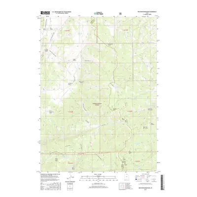
2017 Map of Red Spur Mountain
USGS Topo · Published 2017About this map
Cache National Forest defines this high-elevation landscape along the boundary of Cache and Rich counties. The terrain is characterized by a network of seasonal water sources and drainages, including Wes Reservoir, Deer Lick Reservoir, and the Basin Beaver Ponds. Historic land use and access are evident through named routes such as Baxter Sawmill Rd and Goring Corral Rd, which indicate a legacy of timber and livestock management in the Monte Cristo Range.
Find a feature on this map
66 named features on this map. Tap any name to fly to it.
Don’t see what you’re looking for? This feature index may not catch every label — zoom into the map to look around manually.
Map Details
Editions of this 2017 Red Spur Mountain Map
This is the sole edition of this map. No revisions or reprints were ever made.
Other maps of this area

1912 · Randolph
USGS Topo · 1:125,000

1914 · Logan
USGS Topo · 1:125,000

1916 · Logan
USGS Topo · 1:125,000

1949 · Boulter Mts
USGS Topo · 1:24,000

1954 · Ogden
USGS Topo · 1:250,000

1958 · Ogden
USGS Topo · 1:250,000

1960 · Ogden
USGS Topo · 1:250,000

1969 · Boulder Mtn
USGS Topo · 1:24,000
1969 · Birch Creek Reservoirs
USGS Topo · 1:24,000
1969 · Hardware Ranch
USGS Topo · 1:24,000