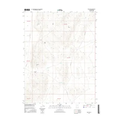
2017 Map of Red Tops
USGS Topo · Published 2017About this map
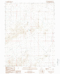
The House Range dominates the central topography of this Millard County landscape, a region defined by dramatic elevation changes and volcanic features such as the Lava Dam. This 2017 U.S. Geological Survey record reveals a desert environment managed for water resources, with the Steamboat Pass Reservoir and Johnson Pond serving as critical collection points in an otherwise arid expanse. The map follows the passage of Red Wash and Steamboat Wash, which carve through the terrain near landmarks like Steamboat Mtn and the Red Tops. Transport across this portion of the Great Basin is limited to primitive routes like Tule Valley Rd and Steamboat Pass Rd, highlighting the isolation and topographic challenges of the Steamboat Pass area and the adjacent Black Hills.
Find a feature on this map
19 named features on this map. Tap any name to fly to it.
Don’t see what you’re looking for? This feature index may not catch every label — zoom into the map to look around manually.
Map Details
Editions of this 2017 Red Tops Map
This is the sole edition of this map. No revisions or reprints were ever made.
Other maps of this area

1953 · Richfield
USGS Topo · 1:250,000

1958 · Richfield
USGS Topo · 1:250,000

1960 · Frisco Peak
USGS Topo · 1:62,500

1960 · Beaver Lake Mts.
USGS Topo · 1:62,500

1960 · The Barn
USGS Topo · 1:62,500
1972 · Needle Point
USGS Topo · 1:24,000
1972 · Sevier Lake SW
USGS Topo · 1:24,000

1980 · Wah Wah Mts. North
USGS Topo · 1:100,000
1989 · Brown Knoll
USGS Topo · 1:24,000
1989 · Fifteenmile Point
USGS Topo · 1:24,000