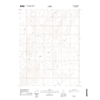
2023 Map of Red Tops
USGS Topo · Published 2023About this map
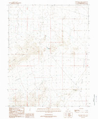
The House Range dominates this portion of Millard County, shaping a landscape defined by dramatic geological formations and remote water sources. In the western reaches, the Tule Valley provides a broad corridor for the Tule Valley Rd, while the central terrain is marked by the distinct elevations of Steamboat Mtn and the volcanic character of Lava Dam. Water is a scarce but vital element here, represented by the ephemeral Red Wash and Steamboat Wash, as well as human-engineered features like the Steamboat Pass Reservoir and Johnson Pond. This recent survey captures the enduring isolation of these Great Basin landforms, where landmarks such as Steamboat Pass serve as key navigational points through the ridges of the Black Hills.
Find a feature on this map
14 named features on this map. Tap any name to fly to it.
Don’t see what you’re looking for? This feature index may not catch every label — zoom into the map to look around manually.
Map Details
Editions of this 2023 Red Tops Map
This is the sole edition of this map. No revisions or reprints were ever made.
Other maps of this area

1953 · Richfield
USGS Topo · 1:250,000

1958 · Richfield
USGS Topo · 1:250,000

1960 · Frisco Peak
USGS Topo · 1:62,500

1960 · Beaver Lake Mts.
USGS Topo · 1:62,500

1960 · The Barn
USGS Topo · 1:62,500
1972 · Needle Point
USGS Topo · 1:24,000
1972 · Sevier Lake SW
USGS Topo · 1:24,000

1980 · Wah Wah Mts. North
USGS Topo · 1:100,000
1989 · Brown Knoll
USGS Topo · 1:24,000
1989 · Fifteenmile Point
USGS Topo · 1:24,000