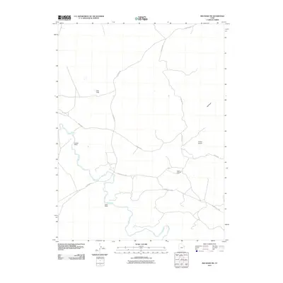
2011 Map of Red Wash SW
USGS Topo · Published 2011About this map
The White River meanders through this arid landscape in Uintah County, creating a distinct hydrological corridor punctuated by drainage features like Coyote Wash and Sand Wash. This 2011 survey documents a region defined by the intersection of industrial development and geological landmarks, most notably the Chapita Wells Gas Field. The infrastructure of the energy industry is evident in the layout of Mountain Fuel Brg and the network of roads, including Watson Rd and Glen Bench Rd, which navigate the high desert terrain.
Find a feature on this map
10 named features on this map. Tap any name to fly to it.
Don’t see what you’re looking for? This feature index may not catch every label — zoom into the map to look around manually.
Map Details
Editions of this 2011 Red Wash SW Map
This is the sole edition of this map. No revisions or reprints were ever made.
Other maps of this area

1885 · East Tavaputs
USGS Topo · 1:250,000

1885 · Ashley
USGS Topo · 1:250,000

1907 · Jensen
USGS Topo · 1:125,000

1910 · Jensen
USGS Topo · 1:125,000

1917 · Vernal
USGS Topo · 1:125,000

1954 · Vernal
USGS Topo · 1:250,000

1956 · Grand Junction
USGS Topo · 1:250,000

1958 · Vernal
USGS Topo · 1:250,000

1959 · Grand Junction
USGS Topo · 1:250,000

1960 · Vernal
USGS Topo · 1:250,000