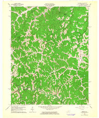
1962 Map of Redbush
USGS Topo · Published 1964About this map
Redbush and its surrounding hollows are defined by an extensive network of gas wells and pipelines that intersect the steep hills of eastern Kentucky. This area, encompassing parts of the Martha Pool within the Gas and Oil Field, shows a landscape where industrial extraction and rural settlement coexist. Small communities and postal outposts like Keaton, Terryville, and Win Po are connected by narrow roads following the intricate drainage of Blaine Creek and Little Paint Creek.
Find a feature on this map
52 named features on this map. Tap any name to fly to it.
Don’t see what you’re looking for? This feature index may not catch every label — zoom into the map to look around manually.
Map Details
Editions of this 1962 Redbush Map
3 editions found
Other maps of this area

1886 · Prestonsburg
USGS Topo · 1:125,000

1889 · Salyersville
USGS Topo · 1:125,000

1891 · Salyersville
USGS Topo · 1:125,000

1892 · Prestonsburg
USGS Topo · 1:125,000

1899 · Salyersville
USGS Topo · 1:125,000

1903 · Kenova
USGS Topo · 1:125,000

1904 · Kenova
USGS Topo · 1:125,000

1915 · Paintsville
USGS Topo · 1:48,000

1917 · Paintsville
USGS Topo · 1:62,500

1950 · Isonville
USGS Topo · 1:24,000