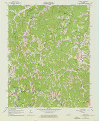
1962 Map of Redbush
USGS Topo · Published 1975About this map
Gas and Oil Field operations dominate the drainage basins of Blaine Creek and Keaton Fork in this mid-century survey of the Johnson County hill country. The landscape is a dense network of extraction and local commerce, anchored by settlements like Redbush and Flatgap. Cultural life is marked by numerous country churches and schools, such as Point Pleasant Ch and the Cuba Sch, alongside several family burial grounds including Salyers Cem. The rugged topography is punctuated by natural landmarks like the Natural Bridge near Lester Branch, while the Martha Pool area shows the concentration of petroleum activity in the northern portion of the quadrangle. Transportation is defined by winding state routes that follow the narrow valley floors of Mudlick Creek and Patterson Creek, connecting remote hollows to the larger county network.
Find a feature on this map
78 named features on this map. Tap any name to fly to it.
Don’t see what you’re looking for? This feature index may not catch every label — zoom into the map to look around manually.
Map Details
Editions of this 1962 Redbush Map
3 editions found
Other maps of this area

1886 · Prestonsburg
USGS Topo · 1:125,000

1889 · Salyersville
USGS Topo · 1:125,000

1891 · Salyersville
USGS Topo · 1:125,000

1892 · Prestonsburg
USGS Topo · 1:125,000

1899 · Salyersville
USGS Topo · 1:125,000

1903 · Kenova
USGS Topo · 1:125,000

1904 · Kenova
USGS Topo · 1:125,000

1915 · Paintsville
USGS Topo · 1:48,000

1917 · Paintsville
USGS Topo · 1:62,500

1950 · Isonville
USGS Topo · 1:24,000