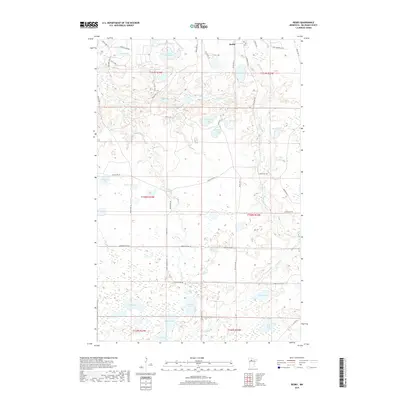
2019 Map of Redby
USGS Topo · Published 2019About this map
The settlement of Redby sits on the northern edge of this northern Minnesota landscape, serving as a focal point for a region defined by an intricate network of wetlands and glacial lakes. Drainage patterns are dominated by the Mud River and meandering waterways such as Pike Cr and Little Pike Cr, which connect numerous smaller basins. The southern portion of the map is particularly dense with water bodies including Tenmile Lake, Rice Lake, and Bass Lake, while the northern area features the larger expanse of Lake Shemahgun. A grid of reservation roads and logging routes, such as Lumberjack Rd NW and Resvn Hwy 12, provides access through the forest and marshland, illustrating the modern infrastructure overlaid on this watery terrain. This map captures the intersection of traditional land use and contemporary transportation in Beltrami County.
Find a feature on this map
56 named features on this map. Tap any name to fly to it.
Don’t see what you’re looking for? This feature index may not catch every label — zoom into the map to look around manually.
Map Details
Editions of this 2019 Redby Map
This is the sole edition of this map. No revisions or reprints were ever made.
Other maps of this area

1919 · Solway
USGS Topo · 1:62,500

1920 · Buena Vista
USGS Topo · 1:62,500

1943 · Solway
USGS Topo · 1:62,500

1954 · Bemidji
USGS Topo · 1:250,000

1957 · Bemidji
USGS Topo · 1:250,000

1958 · Bemidji
USGS Topo · 1:250,000

1972 · Redby
USGS Topo · 1:24,000

1972 · White Fish Lake
USGS Topo · 1:24,000
1972 · Red Lake
USGS Topo · 1:24,000
1972 · Nebish
USGS Topo · 1:24,000