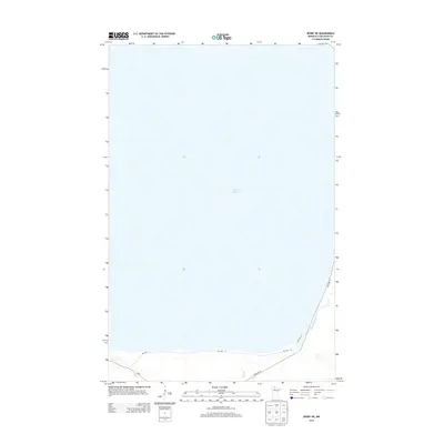
2013 Map of Redby NE
USGS Topo · Published 2013About this map
Lower Red Lake dominates this northern Minnesota landscape, with its vast surface area stretching across the majority of the quadrangle. Along the southern and eastern shorelines, the terrain transitions into a network of tributaries and road corridors that define the local geography. The Blackduck River winds through the southeastern corner, eventually meeting the lake after crossing under Res Hwy 18 and Res Hwy 72. In the southwest, the small flow of Hay Cr enters the lake near the junction of several regional routes.
Find a feature on this map
7 named features on this map. Tap any name to fly to it.
Don’t see what you’re looking for? This feature index may not catch every label — zoom into the map to look around manually.
Map Details
Editions of this 2013 Redby NE Map
This is the sole edition of this map. No revisions or reprints were ever made.
Other maps of this area

1919 · Fox
USGS Topo · 1:62,500

1919 · Quiring
USGS Topo · 1:62,500

1919 · Ponemah
USGS Topo · 1:62,500

1943 · Ponemah
USGS Topo · 1:62,500

1954 · Bemidji
USGS Topo · 1:250,000

1954 · Roseau
USGS Topo · 1:250,000

1957 · Roseau
USGS Topo · 1:250,000

1957 · Bemidji
USGS Topo · 1:250,000

1958 · Bemidji
USGS Topo · 1:250,000

1958 · Roseau
USGS Topo · 1:250,000