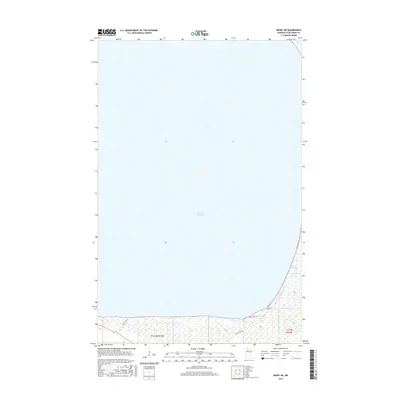
2016 Map of Redby NE
USGS Topo · Published 2016About this map
Lower Red Lake dominates this northern Minnesota landscape, covering the vast majority of the quadrangle with its open waters. The shoreline transition in the southeastern corner reveals a complex network of wetlands and small drainages where the Blackduck River meets the lake. This 2016 survey illustrates the remote character of the Red Lake Reservation, where modern infrastructure is limited to a handful of strategic routes like Resvn Hwy 72 and Resvn Hwy 15. The map provides a clear look at the intersection of tribal land management and the natural hydrology of the region, specifically within the boundaries of t151n r33w and t151n r32w. The area remains largely undeveloped, defined by its water-to-land interface and the primary access roads that skirt the southern and eastern lake margins.
Find a feature on this map
7 named features on this map. Tap any name to fly to it.
Don’t see what you’re looking for? This feature index may not catch every label — zoom into the map to look around manually.
Map Details
Editions of this 2016 Redby NE Map
This is the sole edition of this map. No revisions or reprints were ever made.
Other maps of this area

1919 · Fox
USGS Topo · 1:62,500

1919 · Quiring
USGS Topo · 1:62,500

1919 · Ponemah
USGS Topo · 1:62,500

1943 · Ponemah
USGS Topo · 1:62,500

1954 · Bemidji
USGS Topo · 1:250,000

1954 · Roseau
USGS Topo · 1:250,000

1957 · Roseau
USGS Topo · 1:250,000

1957 · Bemidji
USGS Topo · 1:250,000

1958 · Bemidji
USGS Topo · 1:250,000

1958 · Roseau
USGS Topo · 1:250,000