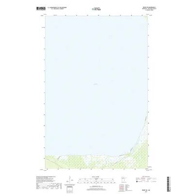
2019 Map of Redby NE
USGS Topo · Published 2019About this map
Lower Red Lake dominates the majority of this quadrangle, illustrating the immense scale of one of Minnesota's most significant water bodies. Along the southeastern shore, the Blackduck River feeds into the lake, creating a complex wetland environment that defines the local hydrology. This 2019 survey documents the tribal infrastructure within the Red Lake Reservation, where a network of primary transit routes including Resvn Hwy 15, Resvn Hwy 18, and Resvn Hwy 72 converge near the shoreline. The transition from the open waters of the lake to the densely wooded and marshy terrain of the interior is clearly delineated, marking the natural boundaries of the t151n r33w and t151n r32w townships.
Find a feature on this map
7 named features on this map. Tap any name to fly to it.
Don’t see what you’re looking for? This feature index may not catch every label — zoom into the map to look around manually.
Map Details
Editions of this 2019 Redby NE Map
This is the sole edition of this map. No revisions or reprints were ever made.
Other maps of this area

1919 · Fox
USGS Topo · 1:62,500

1919 · Quiring
USGS Topo · 1:62,500

1919 · Ponemah
USGS Topo · 1:62,500

1943 · Ponemah
USGS Topo · 1:62,500

1954 · Bemidji
USGS Topo · 1:250,000

1954 · Roseau
USGS Topo · 1:250,000

1957 · Roseau
USGS Topo · 1:250,000

1957 · Bemidji
USGS Topo · 1:250,000

1958 · Bemidji
USGS Topo · 1:250,000

1958 · Roseau
USGS Topo · 1:250,000