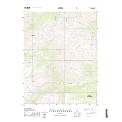
2019 Map of Redcloud Peak
USGS Topo · Published 2019About this map
Burrows Park and the surrounding high-altitude drainage systems of Hinsdale County are captured in this recent survey, showcasing the complex topography of the San Juan Mountains. The landscape is defined by its deep drainages, including Grizzly Gulch, Cataract Gulch, and Alpine Gulch, which feed into the Lake Fork and other primary waterways. Notable summits such as Redcloud Peak and Sunshine Peak dominate the eastern portion of the map, while Whitecross Mtn stands to the west. This area, largely contained within the Gunnison National Forest, retains the infrastructure of early mountain access via routes like the Shelf Rd and Co RD 20. The distribution of named gulches and high-mountain lakes like Cooper Lake illustrates the intricate alpine geography and the historical naming conventions of early miners and explorers who traversed these high passes.
Find a feature on this map
35 named features on this map. Tap any name to fly to it.
Don’t see what you’re looking for? This feature index may not catch every label — zoom into the map to look around manually.
Map Details
Editions of this 2019 Redcloud Peak Map
This is the sole edition of this map. No revisions or reprints were ever made.
Other maps of this area

1897 · Silverton
USGS Topo · 1:62,500

1901 · Silverton
USGS Topo · 1:62,500

1902 · Silverton
USGS Topo · 1:62,500

1902 · Ouray
USGS Topo · 1:62,500

1903 · Lake City
USGS Topo · 1:62,500

1904 · Ouray
USGS Topo · 1:62,500

1905 · Lake City
USGS Topo · 1:62,500

1905 · San Cristobal
USGS Topo · 1:125,000

1907 · San Cristobal
USGS Topo · 1:125,000

1908 · Uncompahgre
USGS Topo · 1:125,000