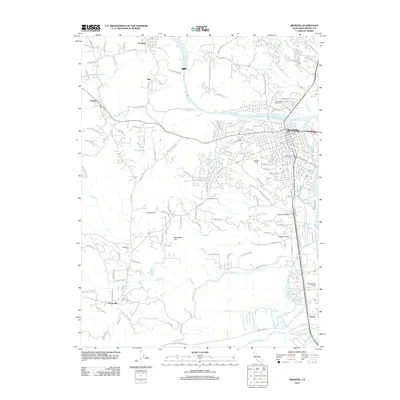
2012 Map of Redding
USGS Topo · Published 2012About this map
The Sacramento River carves through this northern California landscape, anchored by the city of Redding and the adjacent industrial and residential sprawl of the early 21st century. The map documents a complex water management system, featuring the Keswick Reservoir and the Anderson Cottonwood Canal winding through the eastern corridor. Beyond the urban center, the terrain rises toward Sugarloaf and Seventeen Hill, revealing a network of smaller settlements including Keswick, Shasta, and Centerville. Local history is preserved in the location of Saint Josephs Cem and the Middleton Cem, while the aviation history of the area is represented by Benton Field. The landscape is a mix of suburban development and natural drainage, with Olney Cr, Tadpole Cr, and Clear Cr feeding into the river system. This survey provides a clear view of the region's transition from historical gold-country roots to a modern regional hub.
Find a feature on this map
131 named features on this map. Tap any name to fly to it.
Don’t see what you’re looking for? This feature index may not catch every label — zoom into the map to look around manually.
Map Details
Editions of this 2012 Redding Map
This is the sole edition of this map. No revisions or reprints were ever made.
Other maps of this area

1890 · Red Bluff
USGS Topo · 1:250,000

1894 · Red Bluff
USGS Topo · 1:250,000

1901 · Redding
USGS Topo · 1:125,000

1913 · Weaverville
USGS Topo · 1:125,000

1932 · Olinda
USGS Topo · 1:31,680

1935 · Olinda
USGS Topo · 1:31,680

1944 · Redding
USGS Topo · 1:62,500

1944 · French Gulch
USGS Topo · 1:62,500

1946 · Redding
USGS Topo · 1:62,500

1947 · Anderson
USGS Topo · 1:62,500