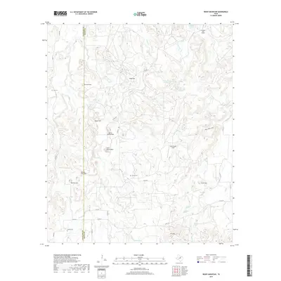
2019 Map of Reddy Mountain
USGS Topo · Published 2019About this map
Reddy Mtn rises above the transition where the high ground of northern Erath County drops toward the drainage of Fork Palo Pinto Cr and Deer Cr. This 2019 survey documents a landscape defined by its water sources and rugged topography, where family names and local history are preserved in several burial grounds, including Tudor Cem, Jay Bird Cem, and Davidson Cem. The presence of several springs, such as Indian Spring and Cottonwood Spring, underscores the vital importance of natural water sources in this part of Texas.
Find a feature on this map
46 named features on this map. Tap any name to fly to it.
Don’t see what you’re looking for? This feature index may not catch every label — zoom into the map to look around manually.
Map Details
Editions of this 2019 Reddy Mountain Map
This is the sole edition of this map. No revisions or reprints were ever made.
Other maps of this area

1890 · Stephenville
USGS Topo · 1:125,000

1890 · Breckenridge
USGS Topo · 1:125,000

1891 · Palo Pinto
USGS Topo · 1:125,000

1894 · Eastland
USGS Topo · 1:125,000

1918 · Palo Pinto
USGS Topo · 1:125,000

1920 · Stephenville
USGS Topo · 1:125,000

1954 · Abilene
USGS Topo · 1:250,000

1958 · Abilene
USGS Topo · 1:250,000

1959 · Gordon
USGS Topo · 1:62,500

1965 · Huckabay SW
USGS Topo · 1:24,000