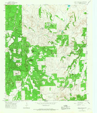
1965 Map of Reddy Mountain
USGS Topo · Published 1967About this map
The X Ray Gas Field and several scattered Mine Dumps define the industrial character of this Erath and Eastland County borderlands region in the mid-1960s. The landscape is marked by prominent peaks such as Reddy Mountain, Tallow Face Mountain, and Washout Mountain, which overlook a network of seasonal watercourses including South Fork Palo Pinto Creek and Turkey Creek. The presence of an Old Railroad Grade in the north indicates the shifting transportation infrastructure of the area, while smaller features like Thurber Lake and Lake Tiberias provide localized water sources in this hilly terrain.
Find a feature on this map
41 named features on this map. Tap any name to fly to it.
Don’t see what you’re looking for? This feature index may not catch every label — zoom into the map to look around manually.
Map Details
Editions of this 1965 Reddy Mountain Map
This is the sole edition of this map. No revisions or reprints were ever made.
Other maps of this area

1890 · Stephenville
USGS Topo · 1:125,000

1890 · Breckenridge
USGS Topo · 1:125,000

1891 · Palo Pinto
USGS Topo · 1:125,000

1894 · Eastland
USGS Topo · 1:125,000

1918 · Palo Pinto
USGS Topo · 1:125,000

1920 · Stephenville
USGS Topo · 1:125,000

1954 · Abilene
USGS Topo · 1:250,000

1958 · Abilene
USGS Topo · 1:250,000

1959 · Gordon
USGS Topo · 1:62,500

1965 · Huckabay SW
USGS Topo · 1:24,000