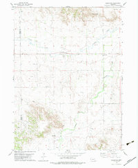
1979 Map of Redington
USGS Topo · Published 1979About this map
Redington serves as the central settlement in this portion of the Nebraska Panhandle, situated where the valley of Pumpkin Creek meets the northern reaches of the Lawrence Fork. The landscape is defined by the sharp transition from the broad creek bottomlands to the prominent escarpments of the Wildcat Hills, marked by landmarks such as Redington Gap and the distinctive Twin Mounds. The region's economy in the late 1970s is clearly etched into the map through an active Oil Field and numerous scattered Well sites.
Find a feature on this map
15 named features on this map. Tap any name to fly to it.
Don’t see what you’re looking for? This feature index may not catch every label — zoom into the map to look around manually.
Map Details
Editions of this 1979 Redington Map
2 editions found
Other maps of this area

1898 · Camp Clarke
USGS Topo · 1:125,000

1954 · Scottsbluff
USGS Topo · 1:250,000

1958 · Scottsbluff
USGS Topo · 1:250,000

1965 · Bridgeport NW
USGS Topo · 1:24,000

1965 · South Bayard
USGS Topo · 1:24,000

1965 · McGrew
USGS Topo · 1:24,000

1972 · Horsehead Ranch
USGS Topo · 1:24,000

1973 · Bridgeport SW
USGS Topo · 1:24,000

1973 · Potter 2 NW
USGS Topo · 1:24,000
1973 · Potter 2 NE
USGS Topo · 1:24,000