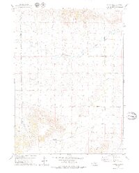
1979 Map of Redington
USGS Topo · Published 1979About this map
Redington stands as the primary settlement in this 1970s landscape, positioned near the northern bank of Pumpkin Creek. The topography is defined by dramatic rises and breaks, including the notable Redington Gap and high points like Langs Point, Round Rock, and the Twin Mounds. The region's economic activity is clearly marked by a sprawling Oil Field in the southwestern quadrant, supported by numerous Oil Well sites and a crisscrossing Pipeline network. Water management in this semi-arid environment is vital, evidenced by the many Well and Spring locations scattered across the rangeland. Transportation and infrastructure are specialized, featuring the Schuler-Olsen Landing Strip and multiple Gravel Pit operations. The map also records the jurisdictional boundary between Banner County and Morrill County, showing how these borders intersect the natural flow of Lawrence Fork.
Find a feature on this map
15 named features on this map. Tap any name to fly to it.
Don’t see what you’re looking for? This feature index may not catch every label — zoom into the map to look around manually.
Map Details
Editions of this 1979 Redington Map
2 editions found
Other maps of this area

1898 · Camp Clarke
USGS Topo · 1:125,000

1954 · Scottsbluff
USGS Topo · 1:250,000

1958 · Scottsbluff
USGS Topo · 1:250,000

1965 · Bridgeport NW
USGS Topo · 1:24,000

1965 · South Bayard
USGS Topo · 1:24,000

1965 · McGrew
USGS Topo · 1:24,000

1972 · Horsehead Ranch
USGS Topo · 1:24,000

1973 · Bridgeport SW
USGS Topo · 1:24,000

1973 · Potter 2 NW
USGS Topo · 1:24,000
1973 · Potter 2 NE
USGS Topo · 1:24,000