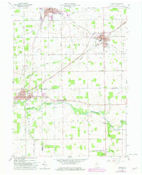
1960 Map of Redkey
USGS Topo · Published 1982About this map
The Mississinewa River winds through this landscape at the intersection of Delaware, Jay, and Randolph counties, anchoring a region defined by its agricultural foundations and early industrial rail links. The towns of Dunkirk and Redkey serve as primary hubs, with the latter showing a distinct grid of streets and community landmarks like the Community Church. Transportation infrastructure is dominated by the Conrail and Norfolk and Western railroads, which facilitated the movement of goods through small settlements like Fairview and Shedville.
Find a feature on this map
43 named features on this map. Tap any name to fly to it.
Don’t see what you’re looking for? This feature index may not catch every label — zoom into the map to look around manually.
Map Details
Editions of this 1960 Redkey Map
2 editions found
Other maps of this area

1952 · Maxville
USGS Topo · 1:24,000

1952 · Muncie East
USGS Topo · 1:24,000

1952 · Farmland
USGS Topo · 1:24,000

1953 · Muncie
USGS Topo · 1:250,000

1956 · Muncie
USGS Topo · 1:250,000

1960 · Pennville
USGS Topo · 1:24,000

1960 · Hartford City East
USGS Topo · 1:24,000

1960 · Blaine
USGS Topo · 1:24,000

1960 · Eaton
USGS Topo · 1:24,000

1960 · Ridgeville
USGS Topo · 1:24,000