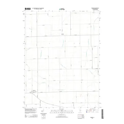
2015 Map of Redmon
USGS Topo · Published 2015About this map
Redmon serves as a primary settlement node in this portion of Edgar County, where a grid of rural roads meets local streets like Springfield St and Hickory St. The landscape is defined by its sophisticated agricultural water management system, illustrated by engineered features such as the Shilah Special Drainage Ditch and Shiloh Number 3 Drainage Ditch. These man-made channels work alongside natural waterways like Brushy Fork and the Little Embarras River to drain the fertile prairie lands. Smaller hamlets like Garland and Mays sit at quiet country crossroads, while the eastern edge of the quadrangle is traced by the winding S Fork Brouilletts Cr. The map captures the enduring geometry of Midwestern township and range surveying, punctuated by family-named landmarks and small creek crossings like Catfish Cr and Sugar Cr.
Find a feature on this map
47 named features on this map. Tap any name to fly to it.
Don’t see what you’re looking for? This feature index may not catch every label — zoom into the map to look around manually.
Map Details
Editions of this 2015 Redmon Map
This is the sole edition of this map. No revisions or reprints were ever made.
Other maps of this area

1946 · Kansas
USGS Topo · 1:62,500

1947 · Ridge Farm
USGS Topo · 1:62,500

1947 · Paris
USGS Topo · 1:62,500

1949 · Kansas
USGS Topo · 1:62,500

1949 · Paris
USGS Topo · 1:62,500

1953 · Indianapolis
USGS Topo · 1:250,000

1956 · Indianapolis
USGS Topo · 1:250,000

1956 · Newman
USGS Topo · 1:62,500

1957 · Indianapolis
USGS Topo · 1:250,000

1962 · Indianapolis
USGS Topo · 1:250,000