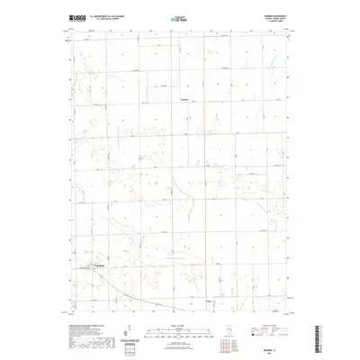
2021 Map of Redmon
USGS Topo · Published 2021About this map
Redmon serves as the primary settlement in this section of Edgar County, situated along 133 and E 1190th Rd. The landscape is defined by an extensive network of water management features, including the Shiloh Special Drainage Ditch and Shiloh Number 3 Drainage Ditch, which redirect water through the agricultural plains. These engineered waterways sit alongside natural drainage systems like the Little Embarras River and Brushy Fork. Smaller localities such as Garland and Mays dot the grid of county roads, connected by routes like E 1800th Rd and 1700 N. Genealogists and local historians can trace the intersection of early water rights and land development through the named creeks, such as Catfish Cr and S Fork Brouilletts Cr, which weave through the townships.
Find a feature on this map
29 named features on this map. Tap any name to fly to it.
Don’t see what you’re looking for? This feature index may not catch every label — zoom into the map to look around manually.
Map Details
Editions of this 2021 Redmon Map
This is the sole edition of this map. No revisions or reprints were ever made.
Other maps of this area

1946 · Kansas
USGS Topo · 1:62,500

1947 · Ridge Farm
USGS Topo · 1:62,500

1947 · Paris
USGS Topo · 1:62,500

1949 · Kansas
USGS Topo · 1:62,500

1949 · Paris
USGS Topo · 1:62,500

1953 · Indianapolis
USGS Topo · 1:250,000

1956 · Indianapolis
USGS Topo · 1:250,000

1956 · Newman
USGS Topo · 1:62,500

1957 · Indianapolis
USGS Topo · 1:250,000

1962 · Indianapolis
USGS Topo · 1:250,000