1966 Map of Redmond Canyon
USGS Topo · Published 1967About this map
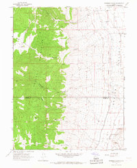
The Old Indian Treaty Boundary runs north-to-south across the eastern foothills, marking a significant historical line of demarcation between the Valley Mountains and the lower Sevier Valley. This 1966 field-checked survey reveals an intricate network of irrigation and mining activity concentrated on the eastern edge of the range. The agricultural needs of the valley are serviced by the Piute Canal, Vermillion Canal, and the Little Ditch, which parallel the base of the mountains.
Find a feature on this map
22 named features on this map. Tap any name to fly to it.
Don’t see what you’re looking for? This feature index may not catch every label — zoom into the map to look around manually.
Map Details
Editions of this 1966 Redmond Canyon Map
This is the sole edition of this map. No revisions or reprints were ever made.
Other maps of this area

1885 · Manti
USGS Topo · 1:250,000

1885 · Beaver
USGS Topo · 1:250,000

1885 · Sevier Desert
USGS Topo · 1:250,000

1885 · Fish Lake
USGS Topo · 1:250,000

1895 · Manti
USGS Topo · 1:250,000

1896 · Fish Lake
USGS Topo · 1:250,000

1953 · Richfield
USGS Topo · 1:250,000

1953 · Delta
USGS Topo · 1:250,000

1956 · Salina
USGS Topo · 1:250,000

1956 · Price
USGS Topo · 1:250,000