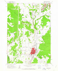
1962 Map of Redmond
USGS Topo · Published 1963About this map
Redmond centers this 1962 topographical study as a growing hub of the high desert, defined by the convergence of the Spokane Portland and Seattle Ry and the Oregon Trunk railway. The town's grid expands toward Roberts Field, while essential community landmarks like Edwin Brown Sch and the Central Oregon District Hospital anchor the residential core.
Find a feature on this map
61 named features on this map. Tap any name to fly to it.
Don’t see what you’re looking for? This feature index may not catch every label — zoom into the map to look around manually.
Map Details
Editions of this 1962 Redmond Map
2 editions found
Other maps of this area

1926 · Bend
USGS Topo · 1:125,000

1929 · Bend
USGS Topo · 1:125,000

1955 · Bend
USGS Topo · 1:250,000

1957 · Bend
USGS Topo · 1:250,000

1958 · Bend
USGS Topo · 1:250,000

1961 · Redmond
USGS Topo · 1:24,000

1962 · Opal City
USGS Topo · 1:24,000

1962 · Forked Horn Butte
USGS Topo · 1:24,000

1962 · Oneil
USGS Topo · 1:24,000
1962 · Cline Falls
USGS Topo · 1:24,000